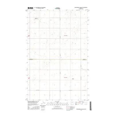
2017 Map of Fourteenmile Coulee SW
USGS Topo · Published 2017About this map
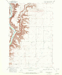
The boundary between Hill County and Chouteau County bisects this northern Montana landscape, where the terrain is defined by the drainage patterns of seasonal watercourses. The East Fork Black Coulee carves through the northwest, while the southern reaches are marked by Sixmile Coulee. This is a region of vast agricultural sections, organized by a rigid grid of rural roads. Important local thoroughfares like Hingham Rd and Edwards Rd provide the primary north-south transit, connecting remote farmsteads across the undulating prairie. The survey reveals the intersection of these routes with several east-west roads, including Black Coulee Rd W and E Black Coulee Rd, which trace the low-lying coulees and serve as the lifelines for this sparsely populated portion of the High Plains.
Find a feature on this map
13 named features on this map. Tap any name to fly to it.
Don’t see what you’re looking for? This feature index may not catch every label — zoom into the map to look around manually.
Map Details
Editions of this 2017 Fourteenmile Coulee SW Map
This is the sole edition of this map. No revisions or reprints were ever made.
Other maps of this area

1906 · Lonesome
USGS Topo · 1:62,500

1919 · Big Sandy
USGS Topo · 1:125,000

1954 · Shelby
USGS Topo · 1:250,000

1958 · Shelby
USGS Topo · 1:250,000

1969 · Fourteenmile Coulee SW
USGS Topo · 1:24,000

1969 · Fourteenmile Coulee NW
USGS Topo · 1:24,000
1969 · Kenilworth
USGS Topo · 1:24,000
1969 · Fourteenmile Coulee SE
USGS Topo · 1:24,000
1969 · Fourteenmile Coulee NE
USGS Topo · 1:24,000
1969 · Discovery Butte
USGS Topo · 1:24,000