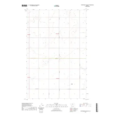
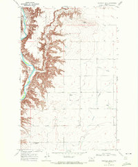
2020 Map of Fourteenmile Coulee SW
USGS Topo · Published 2020About this map
The High Line plains along the northern Montana border define this landscape where Hill Co and Chouteau Co meet. The geography is characterized by the subtle relief of the northern prairie, most notably where Sixmile Coulee cuts through the southeastern section of the map. A rigid grid of section-line roads provides the primary infrastructure for this agricultural region, reflecting the systematic land division of the Public Land Survey System that shaped the American West. Key transit routes including Hingham Rd, Edwards Rd, and Spring Coulee Rd navigate the open spaces, while Black Coulee Rd W and its eastern counterparts like E Black Coulee Rd traverse the southern portion of the quadrangle. This area remains a sparsely populated expanse of Montana's central plains, where watercourses like the coulees provide the most significant breaks in the vast, open terrain.
Find a feature on this map
13 named features on this map. Tap any name to fly to it.
Don’t see what you’re looking for? This feature index may not catch every label — zoom into the map to look around manually.
Map Details
Editions of this 2020 Fourteenmile Coulee SW Map
This is the sole edition of this map. No revisions or reprints were ever made.
Other maps of this area

1906 · Lonesome
USGS Topo · 1:62,500

1919 · Big Sandy
USGS Topo · 1:125,000

1954 · Shelby
USGS Topo · 1:250,000

1958 · Shelby
USGS Topo · 1:250,000

1969 · Fourteenmile Coulee SW
USGS Topo · 1:24,000

1969 · Fourteenmile Coulee NW
USGS Topo · 1:24,000
1969 · Kenilworth
USGS Topo · 1:24,000
1969 · Fourteenmile Coulee SE
USGS Topo · 1:24,000
1969 · Fourteenmile Coulee NE
USGS Topo · 1:24,000
1969 · Discovery Butte
USGS Topo · 1:24,000