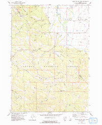
1978 Map of Fourth of July Peak
USGS Topo · Published 1978About this map
Targhee National Forest and the Snake River Range dominate this 1970s landscape, where the rugged topography of the Mountains gives way to the agricultural irrigation of the Teton Basin. The map captures a transition from resource extraction at the Walton Mine to the developed water systems of the Spencer Canal and various other irrigation channels. High-altitude landmarks like Fourth of July Peak, Squirrel Mtn, and Rocky Peak overlook a network of backcountry travel routes, including the Pine Creek Pass and numerous Pack Trails. The drainage patterns are clearly defined by the Teton River and its tributaries such as Rainey Creek and Humble Creek, illustrating the vital water resources that supported the regional economy between the mountains and the basin floor.
Find a feature on this map
51 named features on this map. Tap any name to fly to it.
Don’t see what you’re looking for? This feature index may not catch every label — zoom into the map to look around manually.
Map Details
Editions of this 1978 Fourth of July Peak Map
2 editions found
Other maps of this area

1932 · Irwin
USGS Topo · 1:96,000

1935 · Irwin
USGS Topo · 1:125,000

1943 · Driggs
USGS Topo · 1:62,500

1943 · Garns Mtn
USGS Topo · 1:62,500

1946 · Driggs
USGS Topo · 1:62,500

1946 · Garns Mtn
USGS Topo · 1:62,500

1955 · Driggs
USGS Topo · 1:250,000

1958 · Driggs
USGS Topo · 1:250,000

1962 · Driggs
USGS Topo · 1:250,000
1966 · Palisades Peak
USGS Topo · 1:24,000