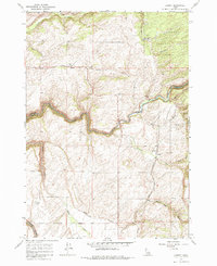
1965 Map of Lamont
USGS Topo · Published 1985About this map
Lamont and Judkins anchor this agricultural and wildland landscape along the Union Pacific line in the mid-1960s. The region is defined by the dramatic incision of Bitch Creek, which winds through deep canyons across the center of the sheet, and the Teton River in the southwest corner. The presence of a Grain Elevator at Lamont and a Gravel Pit near Conant Creek suggests a local economy tied firmly to grain transport and material extraction. Public lands dominate the northeastern quadrant within the Targhee National Forest, including the topographic depression of Catt Hollow. Local infrastructure is further evidenced by a Landing Strip and the winding course of Pinochle Road, reflecting the rural connectivity required to service isolated homesteads and high-altitude timber or grazing lands.
Find a feature on this map
21 named features on this map. Tap any name to fly to it.
Don’t see what you’re looking for? This feature index may not catch every label — zoom into the map to look around manually.
Map Details
Editions of this 1965 Lamont Map
2 editions found
Other maps of this area

1955 · Ashton
USGS Topo · 1:250,000

1955 · Driggs
USGS Topo · 1:250,000

1957 · Warm River Butte
USGS Topo · 1:62,500

1958 · Driggs
USGS Topo · 1:250,000

1958 · Ashton
USGS Topo · 1:250,000

1960 · Ashton
USGS Topo · 1:250,000

1962 · Driggs
USGS Topo · 1:250,000

1965 · Lamont
USGS Topo · 1:24,000

1965 · Packsaddle Lake
USGS Topo · 1:24,000

1965 · Mc Renolds Reservoir
USGS Topo · 1:24,000