
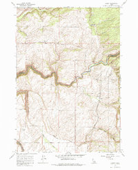
1965 Map of Lamont
USGS Topo · Published 1967About this map
Lamont and Judkins anchor this agricultural landscape along the border of Fremont and Teton counties during the mid-1960s. The Union Pacific railroad cuts directly through the northern half of the sheet, supporting local commerce evidenced by the Grain Elevator in both settlements. The geography is defined by deep drainage systems, most notably the winding path of Bitch Creek as it carves through the volcanic plateau toward the Teton River in the southwest corner. To the east, the terrain rises into the Targhee National Forest, where the higher elevations are marked by seasonal drainages like Swanner Creek and Tepee Creek. This survey captures the region just before significant modernization, showing a network of rural routes such as Pinochle Rd and specialized infrastructure like a remote Landing Strip, reflecting the high-altitude ranching and farming operations of eastern Idaho.
Find a feature on this map
22 named features on this map. Tap any name to fly to it.
Don’t see what you’re looking for? This feature index may not catch every label — zoom into the map to look around manually.
Map Details
Editions of this 1965 Lamont Map
2 editions found
Other maps of this area

1955 · Ashton
USGS Topo · 1:250,000

1955 · Driggs
USGS Topo · 1:250,000

1957 · Warm River Butte
USGS Topo · 1:62,500

1958 · Driggs
USGS Topo · 1:250,000

1958 · Ashton
USGS Topo · 1:250,000

1960 · Ashton
USGS Topo · 1:250,000

1962 · Driggs
USGS Topo · 1:250,000

1965 · Packsaddle Lake
USGS Topo · 1:24,000

1965 · Mc Renolds Reservoir
USGS Topo · 1:24,000

1965 · Clawson
USGS Topo · 1:24,000