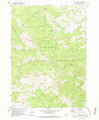
1978 Map of Garns Mtn
USGS Topo · Published 1978About this map
The mining history of the Big Hole Mountains is recorded in detail on this 1978 sheet, where numerous shafts and prospects dot the high-elevation ridges of the Targhee National Forest. Clusters of activity center on Hillman Mine and Packsaddle Mine, while the Idaho Mine sits high on Idaho Ridge. These sites are linked by a complex network of pack trails and jeep trails that navigate the steep drainages of Packsaddle Creek and Hillman Creek. The landscape is dominated by notable summits like Garns Mtn and Ryan Peak, providing a clear look at the logistical challenges of extraction in the Teton Basin region. Remote landmarks such as Blacktail Pass and Government Trail Pass offer specific reference points for researchers tracing the old access routes into the Idaho mountains.
Find a feature on this map
80 named features on this map. Tap any name to fly to it.
Don’t see what you’re looking for? This feature index may not catch every label — zoom into the map to look around manually.
Map Details
Editions of this 1978 Garns Mtn Map
2 editions found
Other maps of this area

1943 · Driggs
USGS Topo · 1:62,500

1943 · Garns Mtn
USGS Topo · 1:62,500

1946 · Driggs
USGS Topo · 1:62,500

1946 · Garns Mtn
USGS Topo · 1:62,500

1955 · Driggs
USGS Topo · 1:250,000

1958 · Driggs
USGS Topo · 1:250,000

1962 · Driggs
USGS Topo · 1:250,000

1965 · Packsaddle Lake
USGS Topo · 1:24,000
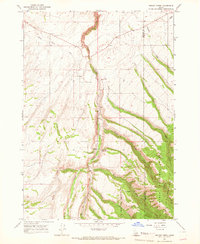
1965 · Wright Creek
USGS Topo · 1:24,000
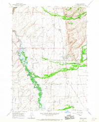
1965 · Tetonia
USGS Topo · 1:24,000