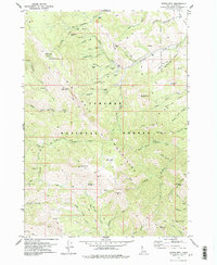
1978 Map of Garns Mtn.
USGS Topo · Published 1978About this map
Mines and ridges define this 1978 survey of Targhee National Forest in Teton County, where the terrain rises sharply toward the peaks of the Big Hole Mountains. Evidence of early industry is scattered across the drainage basins, with locations like Mikesell Mine, Packsaddle Mine, and the Bellcut Mine indicating the search for mineral wealth along the steep draws of Packsaddle Creek. The presence of the Sam (Site) near Brown Bear Creek suggests the footprint of a former settlement or industrial camp that has since transitioned into an archaeological interest.
Find a feature on this map
74 named features on this map. Tap any name to fly to it.
Don’t see what you’re looking for? This feature index may not catch every label — zoom into the map to look around manually.
Map Details
Editions of this 1978 Garns Mtn. Map
2 editions found
Other maps of this area

1943 · Driggs
USGS Topo · 1:62,500

1943 · Garns Mtn
USGS Topo · 1:62,500

1946 · Driggs
USGS Topo · 1:62,500

1946 · Garns Mtn
USGS Topo · 1:62,500

1955 · Driggs
USGS Topo · 1:250,000

1958 · Driggs
USGS Topo · 1:250,000

1962 · Driggs
USGS Topo · 1:250,000

1965 · Packsaddle Lake
USGS Topo · 1:24,000
1965 · Wright Creek
USGS Topo · 1:24,000
1965 · Tetonia
USGS Topo · 1:24,000