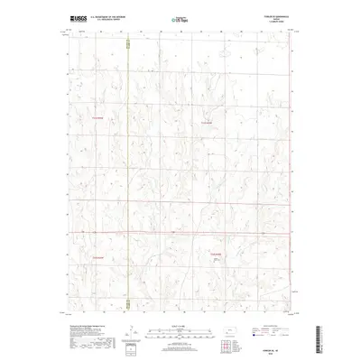
2018 Map of Fowler SE
USGS Topo · Published 2018About this map
The Meade Co and Clark Co border defines this portion of the Kansas plains, where the land is carved by a network of drainage creeks. Golden Plains Cem stands as a primary landmark in this rural landscape, situated west of the junction where W Indian Cr and E Indian Cr meet to form Indian Cr. The topography is characterized by the steady erosion patterns of seasonal waterways like Johns Cr and Gun Cr. This 2018 survey reveals a sparse infrastructure of section-line roads, including H RD and N RD, reflecting the enduring agricultural and ranching layout of the High Plains. The map provides a clear look at the township and range divisions, such as t31s r25w, which have organized this territory since the era of original settlement.
Find a feature on this map
18 named features on this map. Tap any name to fly to it.
Don’t see what you’re looking for? This feature index may not catch every label — zoom into the map to look around manually.
Map Details
Editions of this 2018 Fowler SE Map
This is the sole edition of this map. No revisions or reprints were ever made.
Other maps of this area

1892 · Meade
USGS Topo · 1:125,000

1896 · Ashland
USGS Topo · 1:125,000

1955 · Pratt
USGS Topo · 1:250,000

1955 · Dodge City
USGS Topo · 1:250,000

1958 · Dodge City
USGS Topo · 1:250,000

1959 · Pratt
USGS Topo · 1:250,000

1959 · Dodge City
USGS Topo · 1:250,000

1967 · Bloom
USGS Topo · 1:24,000

1967 · Fowler SE
USGS Topo · 1:24,000

1967 · Fowler SW
USGS Topo · 1:24,000