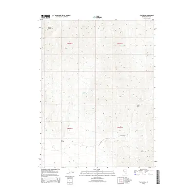
2014 Map of Fox Canyon
USGS Topo · Published 2014About this map
The Fox Range and the Lake Range dominate this corner of Washoe County, where the high desert landscape is defined by its scarce but vital water sources. Numerous watering points like Fox Canyon Spring, Summit Springs, Buckbrush Spring, and Sheep Pass Spring appear as critical markers across the dry terrain. These springs were historically essential for any activity in this portion of the Great Basin, dictating the movement of livestock and travelers through the high passes.
Find a feature on this map
13 named features on this map. Tap any name to fly to it.
Don’t see what you’re looking for? This feature index may not catch every label — zoom into the map to look around manually.
Map Details
Editions of this 2014 Fox Canyon Map
This is the sole edition of this map. No revisions or reprints were ever made.
Other maps of this area

1886 · Granite Range
USGS Topo · 1:250,000

1894 · Granite Range
USGS Topo · 1:250,000

1955 · Lovelock
USGS Topo · 1:250,000

1959 · Lovelock
USGS Topo · 1:250,000

1964 · The Needle Rocks
USGS Topo · 1:24,000

1964 · Tohakum Peak NW
USGS Topo · 1:24,000

1964 · Kumiva Peak
USGS Topo · 1:62,500

1964 · Pyramid NE
USGS Topo · 1:24,000

1965 · Fox Range
USGS Topo · 1:62,500
1984 · Kumiva Peak
USGS Topo · 1:100,000