
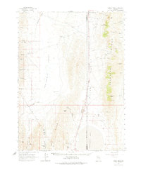
1964 Map of Kumiva Peak
USGS Topo · Published 1966About this map
The Selenite Range dominates this mid-century Nevada landscape, rising sharply between the Poito Valley and the vast sinks of the San Emidio Desert. This 1964 field-checked survey documents a rugged Basin and Range environment where water is the primary architect of human activity. Landmarks like Obrien Ranch and various springs, including Boiling Spring and Jackass Spring, indicate the scarce points of survival in an otherwise arid expanse. In the southwest corner, the boundary of the Pyramid Lake Indian Reservation meets the San Emidio Range near Kits Peak. The eastern edge is defined by the high points of Kumiva Peak and Mt Limbo, while the southern reaches reveal the shoreline of Winnemucca Lake. Historical land use is evidenced by several gravel pits, Quarries, and the Indian Caves located near Falcon Hill, suggesting a long history of human presence and resource extraction in this stark desert region.
Find a feature on this map
47 named features on this map. Tap any name to fly to it.
Don’t see what you’re looking for? This feature index may not catch every label — zoom into the map to look around manually.
Map Details
Editions of this 1964 Kumiva Peak Map
2 editions found
Other maps of this area

1886 · Granite Range
USGS Topo · 1:250,000

1894 · Granite Range
USGS Topo · 1:250,000

1955 · Lovelock
USGS Topo · 1:250,000

1959 · Lovelock
USGS Topo · 1:250,000
1964 · Tohakum Peak NE
USGS Topo · 1:24,000

1964 · Tohakum Peak NW
USGS Topo · 1:24,000

1964 · Gerlach
USGS Topo · 1:62,500

1964 · Pyramid NE
USGS Topo · 1:24,000

1965 · Fox Range
USGS Topo · 1:62,500

1980 · Tenmile
USGS Topo · 1:24,000