1964 Map of Gerlach
USGS Topo · Published 1966About this map
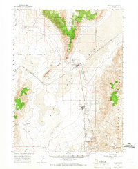
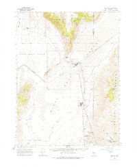
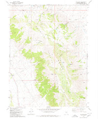
Gerlach sits at the convergence of the Smoke Creek Desert and the Black Rock Desert, serving as a critical rail station along the Western Pacific Railroad. This mid-1960s landscape is defined by the stark transition from flat alkali basins to the towering Granite Range and Selenite Range. To the south, the industrial settlement of Empire is clearly mapped with its radio tower, sewage disposal, and water tanks, contrasting with the more dispersed rural landmarks like Deephole Ranch and the rail siding at Phil. Local geothermal and geological features are prominent, including Great Boiling Spring Park and various prospects and quarries. For those tracing the geography of the Great Basin, the map details numerous vital water sources such as Cottonwood Creek, Texas Basin Spring, and Double Speed Spring, which were essential for ranching and transit in this arid environment.
Find a feature on this map
34 named features on this map. Tap any name to fly to it.
Don’t see what you’re looking for? This feature index may not catch every label — zoom into the map to look around manually.
Map Details
Editions of this 1964 Gerlach Map
2 editions found
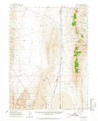
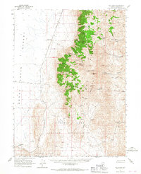
Other maps of this area

1886 · Granite Range
USGS Topo · 1:250,000

1894 · Granite Range
USGS Topo · 1:250,000

1955 · Lovelock
USGS Topo · 1:250,000

1959 · Lovelock
USGS Topo · 1:250,000
1964 · Kumiva Peak
USGS Topo · 1:62,500
1965 · Fox Range
USGS Topo · 1:62,500

1980 · Dry Mountain NW
USGS Topo · 1:24,000
1980 · The Banjo
USGS Topo · 1:24,000
1980 · Tenmile
USGS Topo · 1:24,000

1980 · Trego
USGS Topo · 1:24,000