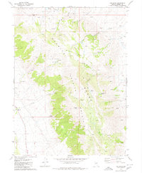
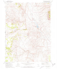
1980 Map of The Banjo
USGS Topo · Published 1980About this map
Granite Mountain dominates this portion of northwestern Nevada, where the high-desert landscape is defined by its seasonal water sources and isolated ranching outposts. Recorded in the late 1970s, the map reveals the sparse settlement patterns of the era, centered on locales like Clear Creek Ranch and The Orchard. The namesake feature, The Banjo, sits between Granite Peak and Little Cottonwood Creek, marking a distinct topographic formation within the range. Dozens of unnamed Springs and named pools like Garden Springs appear across the slopes, indicating the critical nature of water for livestock and survival in this environment. To the north, Wagon Tire Mountain and Wagon Tire Pass suggest the historical path of travel through the peaks, while remote locations such as The Homestead and a lone Prospect near Sheds point to the varied legacy of land use from early pioneers to miners.
Find a feature on this map
29 named features on this map. Tap any name to fly to it.
Don’t see what you’re looking for? This feature index may not catch every label — zoom into the map to look around manually.
Map Details
Editions of this 1980 The Banjo Map
2 editions found
Other maps of this area

1886 · Granite Range
USGS Topo · 1:250,000

1894 · Granite Range
USGS Topo · 1:250,000

1955 · Lovelock
USGS Topo · 1:250,000

1959 · Lovelock
USGS Topo · 1:250,000

1964 · Gerlach
USGS Topo · 1:62,500

1980 · Melody Mountain
USGS Topo · 1:24,000
1980 · Hualapai Flat North
USGS Topo · 1:24,000

1980 · Wall Spring
USGS Topo · 1:24,000
1980 · Hualapai Flat South
USGS Topo · 1:24,000
1981 · Squaw Valley
USGS Topo · 1:24,000