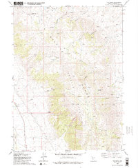
1980 Map of The Banjo
USGS Topo · Published 1980About this map
Granite Range peaks dominate this high-altitude landscape of northwest Nevada, defined by the twin summits of Granite Peak 8957 and Granite Peak 8974. This 1980 survey captures a region where survival depended on water management, evidenced by the scattered network of Springs and sites like Heward Reservoir. Isolated outposts such as Clear Creek Ranch and The Homestead indicate a history of high-desert ranching and settlement tucked into the mountain folds.
Find a feature on this map
29 named features on this map. Tap any name to fly to it.
Don’t see what you’re looking for? This feature index may not catch every label — zoom into the map to look around manually.
Map Details
Editions of this 1980 The Banjo Map
2 editions found
Other maps of this area

1886 · Granite Range
USGS Topo · 1:250,000

1894 · Granite Range
USGS Topo · 1:250,000

1955 · Lovelock
USGS Topo · 1:250,000

1959 · Lovelock
USGS Topo · 1:250,000

1964 · Gerlach
USGS Topo · 1:62,500

1980 · Melody Mountain
USGS Topo · 1:24,000
1980 · The Banjo
USGS Topo · 1:24,000
1980 · Hualapai Flat North
USGS Topo · 1:24,000

1980 · Wall Spring
USGS Topo · 1:24,000
1980 · Hualapai Flat South
USGS Topo · 1:24,000