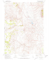
1981 Map of Squaw Valley
USGS Topo · Published 1981About this map
Squaw Valley unfolds as a landscape of remote ranching and mining activity in northern Washoe County. The map documents the livestock and water infrastructure essential to this arid region, including the Squaw Valley Reservoir, the Diversion Dam, and an Aqueduct. Former operations are noted at the Squaw Valley Ranch (Site), while the Fish Ranch appears further downstream along Squaw Creek. This 1981 edition, based on 1970s photography, illustrates how natural springs like Antelope Spring and Big Sawmill Spring dictated the placement of early settlements and seasonal camps.
Find a feature on this map
25 named features on this map. Tap any name to fly to it.
Don’t see what you’re looking for? This feature index may not catch every label — zoom into the map to look around manually.
Map Details
Editions of this 1981 Squaw Valley Map
This is the sole edition of this map. No revisions or reprints were ever made.
Other maps of this area

1886 · Granite Range
USGS Topo · 1:250,000

1894 · Granite Range
USGS Topo · 1:250,000

1955 · Lovelock
USGS Topo · 1:250,000

1959 · Lovelock
USGS Topo · 1:250,000

1964 · Gerlach
USGS Topo · 1:62,500

1980 · Melody Mountain
USGS Topo · 1:24,000
1980 · The Banjo
USGS Topo · 1:24,000

1980 · Wall Spring
USGS Topo · 1:24,000
1981 · Crutcher Canyon
USGS Topo · 1:24,000

1981 · Gerlach
USGS Topo · 1:100,000