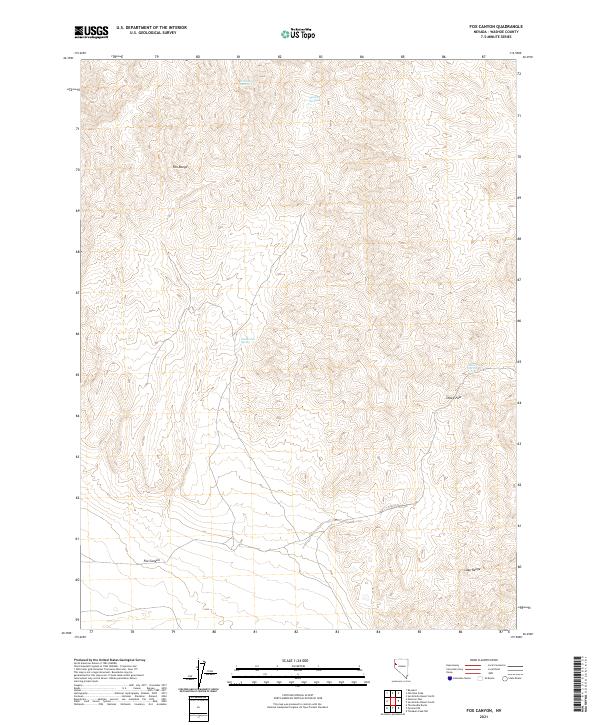
2021 Map of Fox Canyon
USGS Topo · Published 2021About this map
Fox Range and the Lake Range dominate this northern Nevada landscape, where the elevation changes reveal a complex network of high-desert drainage patterns. The 2021 survey documents several vital water sources that have historically sustained life in this arid region, including Fox Canyon Spring and Summit Springs located in the northern reaches. Central to the map is the corridor of Fox Canyon, which provides a natural passage between the high ridges. Further south, the high-elevation Sheep Pass and its associated Sheep Pass Spring mark significant points of navigation for those traversing the high desert. The placement of these springs, including Buckbrush Spring, against the steep contours of the ranges highlights the importance of localized hydrography in an otherwise thirsty terrain.
Find a feature on this map
12 named features on this map. Tap any name to fly to it.
Don’t see what you’re looking for? This feature index may not catch every label — zoom into the map to look around manually.
Map Details
Editions of this 2021 Fox Canyon Map
This is the sole edition of this map. No revisions or reprints were ever made.
Other maps of this area

1886 · Granite Range
USGS Topo · 1:250,000

1894 · Granite Range
USGS Topo · 1:250,000

1955 · Lovelock
USGS Topo · 1:250,000

1959 · Lovelock
USGS Topo · 1:250,000

1964 · The Needle Rocks
USGS Topo · 1:24,000

1964 · Tohakum Peak NW
USGS Topo · 1:24,000

1964 · Kumiva Peak
USGS Topo · 1:62,500

1964 · Pyramid NE
USGS Topo · 1:24,000

1965 · Fox Range
USGS Topo · 1:62,500
1984 · Kumiva Peak
USGS Topo · 1:100,000