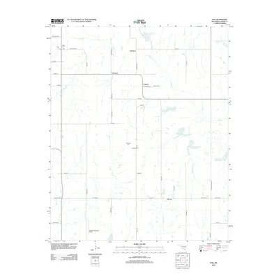
2012 Map of Fox
USGS Topo · Published 2012About this map
The settlement of Fox and the surrounding Carter County oil fields are documented in this 2012 survey, revealing a landscape defined by industrial development and rural infrastructure. Small communities like Clemscott, Graham, and Oil City dot the map, connected by a network of sectional roads such as D1853 Rd and Wilson Rd. The area's economic history is etched into its hydrography and place names, seen in the winding Oil Br and the eponymous Oil City, while legacy sites like Oil Springs Cem and Graham Cem provide essential data for local genealogists.
Find a feature on this map
56 named features on this map. Tap any name to fly to it.
Don’t see what you’re looking for? This feature index may not catch every label — zoom into the map to look around manually.
Map Details
Editions of this 2012 Fox Map
This is the sole edition of this map. No revisions or reprints were ever made.
Other maps of this area

1901 · Addington
USGS Topo · 1:125,000

1901 · Ardmore
USGS Topo · 1:125,000

1918 · Ardmore
USGS Topo · 1:125,000

1957 · Ardmore
USGS Topo · 1:250,000

1963 · Ardmore
USGS Topo · 1:250,000

1968 · Fox NE
USGS Topo · 1:24,000

1969 · Healdton
USGS Topo · 1:24,000

1969 · Lone Grove
USGS Topo · 1:24,000
1969 · Milo
USGS Topo · 1:24,000
1969 · Tatums
USGS Topo · 1:24,000