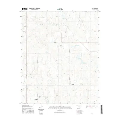
2016 Map of Fox
USGS Topo · Published 2016About this map
The oil-rich landscape of Carter County is documented here during a period of modern industrial and rural transition. Small communities like Fox and Graham anchor the northern landscape, while Oil City and the northern edge of Healdton mark the southern reach of the quadrangle. The naming of landmarks such as Oil Springs Cem and the various tributaries of Caddo Cr, including Hug-me-tight Br, reflects the local vernacular and the historical importance of water resources in this part of Oklahoma.
Find a feature on this map
41 named features on this map. Tap any name to fly to it.
Don’t see what you’re looking for? This feature index may not catch every label — zoom into the map to look around manually.
Map Details
Editions of this 2016 Fox Map
This is the sole edition of this map. No revisions or reprints were ever made.
Other maps of this area

1901 · Addington
USGS Topo · 1:125,000

1901 · Ardmore
USGS Topo · 1:125,000

1918 · Ardmore
USGS Topo · 1:125,000

1957 · Ardmore
USGS Topo · 1:250,000

1963 · Ardmore
USGS Topo · 1:250,000

1968 · Fox NE
USGS Topo · 1:24,000

1969 · Healdton
USGS Topo · 1:24,000

1969 · Lone Grove
USGS Topo · 1:24,000
1969 · Milo
USGS Topo · 1:24,000
1969 · Tatums
USGS Topo · 1:24,000