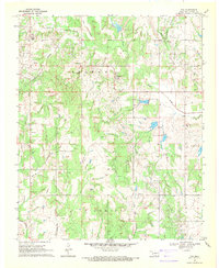
1969 Map of Fox
USGS Topo · Published 1971About this map
The Graham Oil Field and Hewitt Oil Field dominate this 1969 Oklahoma landscape, revealing a region deeply defined by the petroleum industry. Numerous oil and gas wells are scattered across the terrain, interspersed with local centers like Graham, Fox, and Clemscott. The infrastructure of extraction is evident through the network of pipelines and the presence of a dedicated Landing Strip, while the community’s social fabric is anchored by landmarks such as Midway Ch and the Oil Springs Cem.
Find a feature on this map
28 named features on this map. Tap any name to fly to it.
Don’t see what you’re looking for? This feature index may not catch every label — zoom into the map to look around manually.
Map Details
Editions of this 1969 Fox Map
This is the sole edition of this map. No revisions or reprints were ever made.
Other maps of this area

1901 · Addington
USGS Topo · 1:125,000

1901 · Ardmore
USGS Topo · 1:125,000

1918 · Ardmore
USGS Topo · 1:125,000

1957 · Ardmore
USGS Topo · 1:250,000

1963 · Ardmore
USGS Topo · 1:250,000

1968 · Fox NE
USGS Topo · 1:24,000

1969 · Healdton
USGS Topo · 1:24,000

1969 · Lone Grove
USGS Topo · 1:24,000
1969 · Milo
USGS Topo · 1:24,000
1969 · Tatums
USGS Topo · 1:24,000