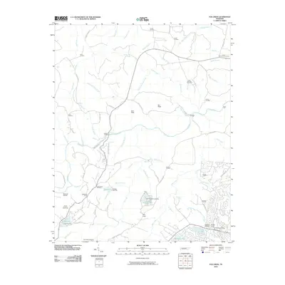
2010 Map of Fox Creek
USGS Topo · Published 2010About this map
The Obed River and its numerous tributaries, including Fox Creek and Otter Creek, carve through the Cumberland Plateau landscape in this 2010 survey of the Fairfield Glade area. This period captures the intersection of traditional Appalachian rural life and modern development, seen in the suburban street networks of Stonehenge Dr and Berkshire Dr emerging near the Fairfield Glade Post Office. Genealogists will find a high density of family-named burial grounds, such as Gulden Cemetery, Elmore Cemetery, and three distinct Turner family plots. Geographic landmarks such as Adams Bridge and Potter Ford indicate long-established river crossings, while the presence of several reservoirs including Frances Lake Dam and Good Neighbor Lake Dam illustrates the transition of the local hydrology toward recreational and residential use. The terrain is further defined by prominent heights like Pilot Knob and Bee Ridge, overlooking the winding South Fork Elmore Creek.
Find a feature on this map
90 named features on this map. Tap any name to fly to it.
Don’t see what you’re looking for? This feature index may not catch every label — zoom into the map to look around manually.
Map Details
Editions of this 2010 Fox Creek Map
This is the sole edition of this map. No revisions or reprints were ever made.
Other maps of this area

1887 · Kingston
USGS Topo · 1:125,000

1891 · Kingston
USGS Topo · 1:125,000

1892 · Pikeville
USGS Topo · 1:125,000

1893 · Kingston
USGS Topo · 1:125,000

1895 · Wartburg
USGS Topo · 1:125,000

1895 · Pikeville
USGS Topo · 1:125,000

1896 · Wartburg
USGS Topo · 1:125,000

1897 · Standingstone
USGS Topo · 1:125,000

1898 · Standingstone
USGS Topo · 1:125,000

1912 · Crossville
USGS Topo · 1:62,500