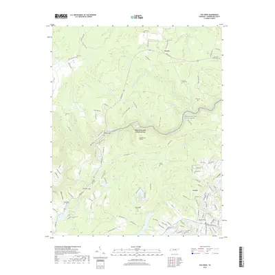
2019 Map of Fox Creek
USGS Topo · Published 2019About this map
Cumberland Plateau terrain dominates this portion of Cumberland County, where the deeply incised gorge of the Obed Wild and Scenic River carves through sandstone layers. The map reveals a transition from the protected river corridor to the developing residential patterns around Peavine and the established rural character near Genesis. This landscape is marked by a high density of family cemeteries, including Peavine Cem, Elmore Cemetery, and multiple Turner family plots, reflecting the deep ancestral roots of the local community.
Find a feature on this map
135 named features on this map. Tap any name to fly to it.
Don’t see what you’re looking for? This feature index may not catch every label — zoom into the map to look around manually.
Map Details
Editions of this 2019 Fox Creek Map
This is the sole edition of this map. No revisions or reprints were ever made.
Other maps of this area

1887 · Kingston
USGS Topo · 1:125,000

1891 · Kingston
USGS Topo · 1:125,000

1892 · Pikeville
USGS Topo · 1:125,000

1893 · Kingston
USGS Topo · 1:125,000

1895 · Wartburg
USGS Topo · 1:125,000

1895 · Pikeville
USGS Topo · 1:125,000

1896 · Wartburg
USGS Topo · 1:125,000

1897 · Standingstone
USGS Topo · 1:125,000

1898 · Standingstone
USGS Topo · 1:125,000

1912 · Crossville
USGS Topo · 1:62,500