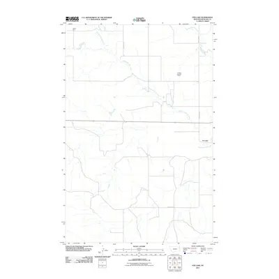
2011 Map of Fox Lake
USGS Topo · Published 2011About this map
Fox Creek and its complex tributaries define this section of Richland County, as the watercourse branches into the Middle Fork Fox Creek and East Fork Fox Creek. The landscape is shaped by rural infrastructure, notably Burke Dam and the Tri-W-Inc Number 2 Dam, which manage local water resources in this prairie environment. The eponymous Fox Lake sits along the eastern edge of the quadrangle, serving as a primary hydrologic landmark. A grid of local thoroughfares, including County Rd 324, County Rd 328, and County Rd 325, provides the framework for the region's agricultural transport and land division during the early 21st century.
Find a feature on this map
9 named features on this map. Tap any name to fly to it.
Don’t see what you’re looking for? This feature index may not catch every label — zoom into the map to look around manually.
Map Details
Editions of this 2011 Fox Lake Map
This is the sole edition of this map. No revisions or reprints were ever made.
Other maps of this area

1909 · Glendive
USGS Topo · 1:250,000

1954 · Glendive
USGS Topo · 1:250,000

1957 · Glendive
USGS Topo · 1:250,000

1958 · Glendive
USGS Topo · 1:250,000

1972 · Butler Table
USGS Topo · 1:24,000

1972 · Fox Lake
USGS Topo · 1:24,000

1972 · Enid SE
USGS Topo · 1:24,000

1972 · Lambert
USGS Topo · 1:24,000
1972 · Mc Cone Heights
USGS Topo · 1:24,000

1972 · Enid
USGS Topo · 1:24,000