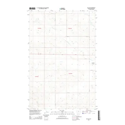
2014 Map of Fox Lake
USGS Topo · Published 2014About this map
Lambert stands at the eastern edge of this landscape, marking the intersection of local routes like 1st Ave NW and Co Road 123. The area is defined by the branching drainage system of the Fox Creek watershed, including the Middle Fork Fox Cr and E Fork Fox Cr. These waterways carve through the terrain as they converge near the central depression of Fox Lake. This 2014 survey illustrates a rural environment primarily organized by the Public Land Survey System, with township boundaries like t23n r55e and t22n r54e providing the grid for numerous county roads. The passage of Mt-200 across the center of the sheet serves as the primary east-west arterial for the ranching and agricultural operations that dominate this section of Richland County.
Find a feature on this map
21 named features on this map. Tap any name to fly to it.
Don’t see what you’re looking for? This feature index may not catch every label — zoom into the map to look around manually.
Map Details
Editions of this 2014 Fox Lake Map
This is the sole edition of this map. No revisions or reprints were ever made.
Other maps of this area

1909 · Glendive
USGS Topo · 1:250,000

1954 · Glendive
USGS Topo · 1:250,000

1957 · Glendive
USGS Topo · 1:250,000

1958 · Glendive
USGS Topo · 1:250,000

1972 · Butler Table
USGS Topo · 1:24,000

1972 · Fox Lake
USGS Topo · 1:24,000

1972 · Enid SE
USGS Topo · 1:24,000

1972 · Lambert
USGS Topo · 1:24,000
1972 · Mc Cone Heights
USGS Topo · 1:24,000

1972 · Enid
USGS Topo · 1:24,000