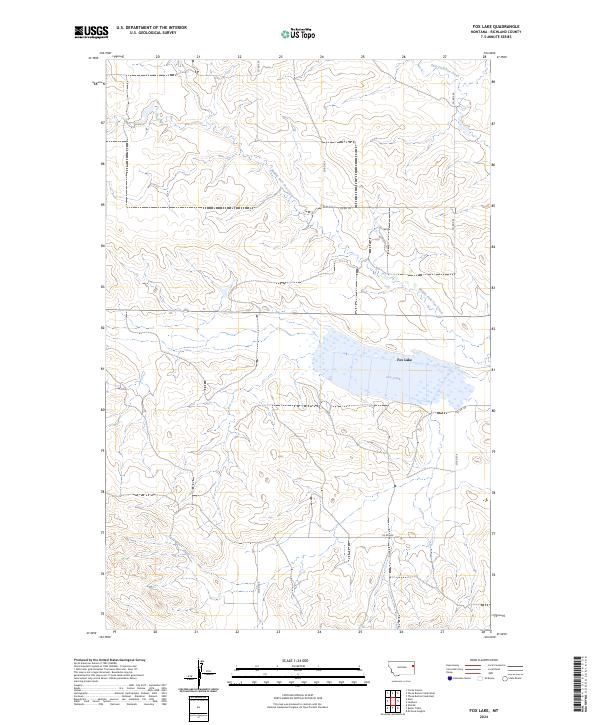
2024 Map of Fox Lake
USGS Topo · Published 2024About this map
Fox Lake serves as the central focal point of this Eastern Montana landscape in Richland County. The hydrology of the region is defined by the winding paths of Fox Creek and its major tributaries, including Middle Fork Fox Creek and East Fork Fox Creek. This modern survey highlights a high-plains environment structured by a precise grid of rural thoroughfares, such as Co Rd 324 and Co Rd 328. The map documents the persistent agricultural and ranching layout of the territory, with land divisions marked by township and range lines like t23n r55e and t22n r55e. For those studying the geography of the northern Missouri River watershed, the map provides a clear view of how water drainage and county roads organize this sparsely populated prairie terrain.
Find a feature on this map
13 named features on this map. Tap any name to fly to it.
Don’t see what you’re looking for? This feature index may not catch every label — zoom into the map to look around manually.
Map Details
Editions of this 2024 Fox Lake Map
This is the sole edition of this map. No revisions or reprints were ever made.
Other maps of this area

1909 · Glendive
USGS Topo · 1:250,000

1954 · Glendive
USGS Topo · 1:250,000

1957 · Glendive
USGS Topo · 1:250,000

1958 · Glendive
USGS Topo · 1:250,000

1972 · Butler Table
USGS Topo · 1:24,000

1972 · Fox Lake
USGS Topo · 1:24,000

1972 · Enid SE
USGS Topo · 1:24,000

1972 · Lambert
USGS Topo · 1:24,000
1972 · Mc Cone Heights
USGS Topo · 1:24,000

1972 · Enid
USGS Topo · 1:24,000