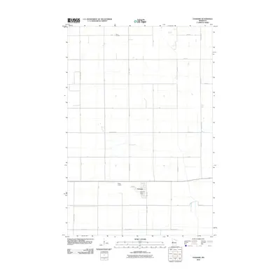
2010 Map of Foxhome
USGS Topo · Published 2010About this map
Foxhome serves as the central hub of this agricultural landscape in Wilkin County, where the village's grid is anchored by the Foxhome Post Office and local streets like Broadway Ave and Hoeling St. The surrounding countryside is defined by an orderly section-line road network, including County Hwy-162 and County Hwy-168, which connects the region's farms and small-scale infrastructure. Just west of the settlement lies Knapp Airport, indicating the area's continued reliance on local aviation. For those researching family history or local land use, the Burau Cemetery stands as a significant landmark in the northern reaches of the quadrangle. The map captures the persistent character of a Midwestern farming community at the start of the 21st century, illustrating how the rural landscape is organized around its primary village and transport corridors.
Find a feature on this map
20 named features on this map. Tap any name to fly to it.
Don’t see what you’re looking for? This feature index may not catch every label — zoom into the map to look around manually.
Map Details
Editions of this 2010 Foxhome Map
This is the sole edition of this map. No revisions or reprints were ever made.
Other maps of this area

1910 · Wendell
USGS Topo · 1:62,500

1913 · Fergus Falls
USGS Topo · 1:62,500

1913 · Wendell
USGS Topo · 1:62,500

1919 · Rothsay
USGS Topo · 1:62,500

1951 · Rothsay
USGS Topo · 1:62,500

1951 · Campbell
USGS Topo · 1:62,500

1953 · Fargo
USGS Topo · 1:250,000

1956 · Fargo
USGS Topo · 1:250,000

1966 · Carlisle
USGS Topo · 1:24,000
1973 · Elizabeth
USGS Topo · 1:24,000