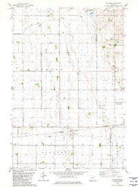
1981 Map of Foxhome
USGS Topo · Published 1981About this map
Foxhome serves as the central hub of this prairie landscape at the boundary of Wilkin Co and Otter Tail Co. The village is deeply tied to its transportation routes, defined by the Burlington railroad line and the Northern roadway. The surrounding terrain is organized into distinct townships including Akron, Andrea, Oscar, Carlisle, and Orwell, where the flat agricultural land is managed by an extensive drainage network featuring County Ditch No 31 and Judicial Ditch No 2. Local history is anchored at sites like Burau Cem, Foxhome Cem, and the rural Townhall. In the eastern section, the National Waterfowl Production Area indicates a shift toward conservation and wetland management alongside the area's industrial Gravel Pits.
Find a feature on this map
21 named features on this map. Tap any name to fly to it.
Don’t see what you’re looking for? This feature index may not catch every label — zoom into the map to look around manually.
Map Details
Editions of this 1981 Foxhome Map
This is the sole edition of this map. No revisions or reprints were ever made.
Other maps of this area

1910 · Wendell
USGS Topo · 1:62,500

1913 · Fergus Falls
USGS Topo · 1:62,500

1913 · Wendell
USGS Topo · 1:62,500

1919 · Rothsay
USGS Topo · 1:62,500

1951 · Rothsay
USGS Topo · 1:62,500

1951 · Campbell
USGS Topo · 1:62,500

1953 · Fargo
USGS Topo · 1:250,000

1956 · Fargo
USGS Topo · 1:250,000

1966 · Carlisle
USGS Topo · 1:24,000
1973 · Elizabeth
USGS Topo · 1:24,000