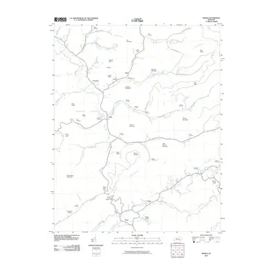
2010 Map of Frakes
USGS Topo · Published 2010About this map
Siler and Frakes serve as central points in this landscape of the Cumberland Plateau, where narrow valley roads follow the winding paths of Poplar Creek and its many tributaries. The area is defined by a series of prominent ridges and peaks, including Bear Wallow Mountain and Goldens Mountain, which separate the various hollows and branch waters. Family history is etched into the terrain through numerous namesake burial sites like the McKiddy Cemetery and Croley Cemetery, often situated on high ground overlooking the small settlements below.
Find a feature on this map
85 named features on this map. Tap any name to fly to it.
Don’t see what you’re looking for? This feature index may not catch every label — zoom into the map to look around manually.
Map Details
Editions of this 2010 Frakes Map
This is the sole edition of this map. No revisions or reprints were ever made.
Other maps of this area

1886 · Cumberland Gap
USGS Topo · 1:125,000

1888 · Cumberland Gap
USGS Topo · 1:125,000

1890 · Williamsburg
USGS Topo · 1:125,000

1891 · Cumberland Gap
USGS Topo · 1:125,000

1894 · Williamsburg
USGS Topo · 1:125,000

1935 · Mingo Mountains
USGS Topo · 1:24,000
1950 · Mingo Mountains
USGS Topo · 1:24,000

1952 · Barbourville
USGS Topo · 1:24,000

1952 · Saxton
USGS Topo · 1:24,000

1952 · Rockholds
USGS Topo · 1:24,000