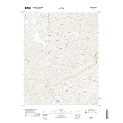
2019 Map of Frakes
USGS Topo · Published 2019About this map
Pine Mountain and the Log Mountains dominate the topography of this southeastern Kentucky landscape, where the borders of Whitley, Knox, and Bell counties converge. The rugged terrain is etched by a dense network of watercourses, including Poplar Cr, Harpes Cr, and Laurel Fork. Small settlements such as Siler, Frakes, and Pearl serve as focal points for the surrounding rural communities.
Find a feature on this map
90 named features on this map. Tap any name to fly to it.
Don’t see what you’re looking for? This feature index may not catch every label — zoom into the map to look around manually.
Map Details
Editions of this 2019 Frakes Map
This is the sole edition of this map. No revisions or reprints were ever made.
Other maps of this area

1886 · Cumberland Gap
USGS Topo · 1:125,000

1888 · Cumberland Gap
USGS Topo · 1:125,000

1890 · Williamsburg
USGS Topo · 1:125,000

1891 · Cumberland Gap
USGS Topo · 1:125,000

1894 · Williamsburg
USGS Topo · 1:125,000

1935 · Mingo Mountains
USGS Topo · 1:24,000
1950 · Mingo Mountains
USGS Topo · 1:24,000

1952 · Barbourville
USGS Topo · 1:24,000

1952 · Saxton
USGS Topo · 1:24,000

1952 · Rockholds
USGS Topo · 1:24,000