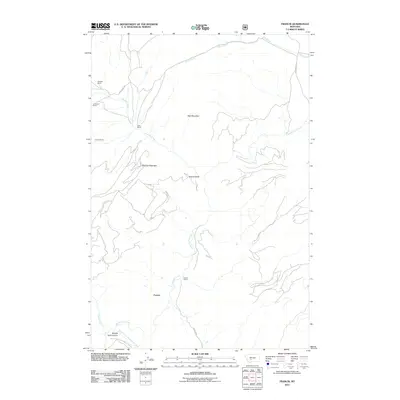
2011 Map of Francis
USGS Topo · Published 2011About this map
Francis stands as a small settlement in Gallatin County, defined by the winding course of Sixteenmile Creek and a network of high-country ranching properties. At the start of the 21st century, this landscape remains characterized by its established family holdings, including Mitchell Ranch, Christison Ranch, and the Doig sites. These ranches are oriented around significant geographic markers like Wall Mountain and Sherlock Mountain, which overlook the deep incision of Middle Fork Canyon to the south. The area's water sources, such as Sherlock Creek, Paddys Run, and Horse Creek, trace the drainage patterns of the Missouri River headwaters region. The presence of Francis Rd and the Middle Fork Sixteenmile Creek Rd highlights the importance of these corridor routes in maintaining connectivity through the mountainous terrain.
Find a feature on this map
20 named features on this map. Tap any name to fly to it.
Don’t see what you’re looking for? This feature index may not catch every label — zoom into the map to look around manually.
Map Details
Editions of this 2011 Francis Map
This is the sole edition of this map. No revisions or reprints were ever made.
Other maps of this area

1886 · Fort Logan
USGS Topo · 1:250,000

1886 · Little Belt Mts.
USGS Topo · 1:250,000

1894 · Little Belt Mts.
USGS Topo · 1:250,000

1897 · Little Belt Mts.
USGS Topo · 1:250,000

1898 · Little Belt Mts.
USGS Topo · 1:250,000

1902 · Little Belt Mts.
USGS Topo · 1:250,000

1948 · White Sulphur Springs
USGS Topo · 1:250,000

1948 · Sixteen
USGS Topo · 1:24,000

1949 · Maudlow
USGS Topo · 1:62,500
1951 · Hatfield Mountain
USGS Topo · 1:24,000