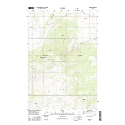
2017 Map of Francis
USGS Topo · Published 2017About this map
The settlement of Francis serves as a lone named focal point in a territory where the boundaries of Broadwater, Meagher, and Gallatin Counties converge. This 2017 survey details a landscape dominated by the Big Belt Mountains and the protected lands of the Helena National Forest. The drainage of Sixteenmile Creek defines the local topography, carving through the dramatic Sixteenmile Canyon and receiving flow from Middle Fork Sixteenmile Creek. High peaks such as Sherlock Mtn and Wall Mtn stand above rugged corridors like Spring Gulch, illustrating the transition from forested heights to the creek valley below. The network of primitive routes, including Sixteenmile Creek Rd and Francis Rd, follows the natural contours of the canyons and ridgelines, marking the persistent paths through this high-country terrain.
Find a feature on this map
29 named features on this map. Tap any name to fly to it.
Don’t see what you’re looking for? This feature index may not catch every label — zoom into the map to look around manually.
Map Details
Editions of this 2017 Francis Map
This is the sole edition of this map. No revisions or reprints were ever made.
Other maps of this area

1886 · Fort Logan
USGS Topo · 1:250,000

1886 · Little Belt Mts.
USGS Topo · 1:250,000

1894 · Little Belt Mts.
USGS Topo · 1:250,000

1897 · Little Belt Mts.
USGS Topo · 1:250,000

1898 · Little Belt Mts.
USGS Topo · 1:250,000

1902 · Little Belt Mts.
USGS Topo · 1:250,000

1948 · White Sulphur Springs
USGS Topo · 1:250,000

1948 · Sixteen
USGS Topo · 1:24,000

1949 · Maudlow
USGS Topo · 1:62,500
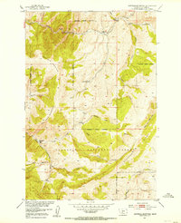
1951 · Hatfield Mountain
USGS Topo · 1:24,000