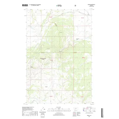
2020 Map of Francis
USGS Topo · Published 2020About this map
Francis sits along the southern edge of this modern survey, marking a small pocket of human settlement in a landscape dominated by the high peaks of the Big Belt Mountains. The area is characterized by deep drainages and winding mountain roads like Sixteen Mile Creek Rd and Francis Rd, which follow the natural contours of the land. Much of the western and central territory is protected within the Helena National Forest, where the topography rises sharply to Sherlock Mtn and Wall Mtn.
Find a feature on this map
27 named features on this map. Tap any name to fly to it.
Don’t see what you’re looking for? This feature index may not catch every label — zoom into the map to look around manually.
Map Details
Editions of this 2020 Francis Map
This is the sole edition of this map. No revisions or reprints were ever made.
Other maps of this area

1886 · Fort Logan
USGS Topo · 1:250,000

1886 · Little Belt Mts.
USGS Topo · 1:250,000

1894 · Little Belt Mts.
USGS Topo · 1:250,000

1897 · Little Belt Mts.
USGS Topo · 1:250,000

1898 · Little Belt Mts.
USGS Topo · 1:250,000

1902 · Little Belt Mts.
USGS Topo · 1:250,000

1948 · White Sulphur Springs
USGS Topo · 1:250,000

1948 · Sixteen
USGS Topo · 1:24,000

1949 · Maudlow
USGS Topo · 1:62,500
1951 · Hatfield Mountain
USGS Topo · 1:24,000