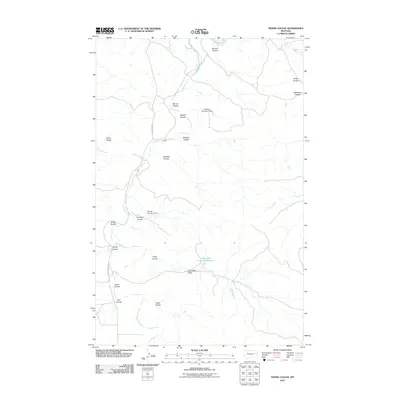
2011 Map of Frank Coulee
USGS Topo · Published 2011About this map
Standing Rock and Indian Rocks provide prominent landmarks in this McCone County landscape, where the drainage systems of the Missouri River basin define the local geography. The area is characterized by an intricate network of coulees, including Halfdahl Coulee, Malone Coulee, and the namesake Frank Coulee, which channel seasonal runoff toward larger watercourses like Big Dry Creek and Flat Creek.
Find a feature on this map
25 named features on this map. Tap any name to fly to it.
Don’t see what you’re looking for? This feature index may not catch every label — zoom into the map to look around manually.
Map Details
Editions of this 2011 Frank Coulee Map
This is the sole edition of this map. No revisions or reprints were ever made.
Other maps of this area

1954 · Jordan
USGS Topo · 1:250,000

1956 · Jordan
USGS Topo · 1:250,000

1958 · Jordan
USGS Topo · 1:250,000

1964 · Jordan
USGS Topo · 1:250,000

1967 · Hagen Gap
USGS Topo · 1:24,000
1967 · Maxwell Coulee
USGS Topo · 1:24,000

1967 · Coal Creek
USGS Topo · 1:24,000

1967 · Frank Coulee
USGS Topo · 1:24,000

1972 · Short Creek
USGS Topo · 1:24,000

1972 · Flat Creek School
USGS Topo · 1:24,000