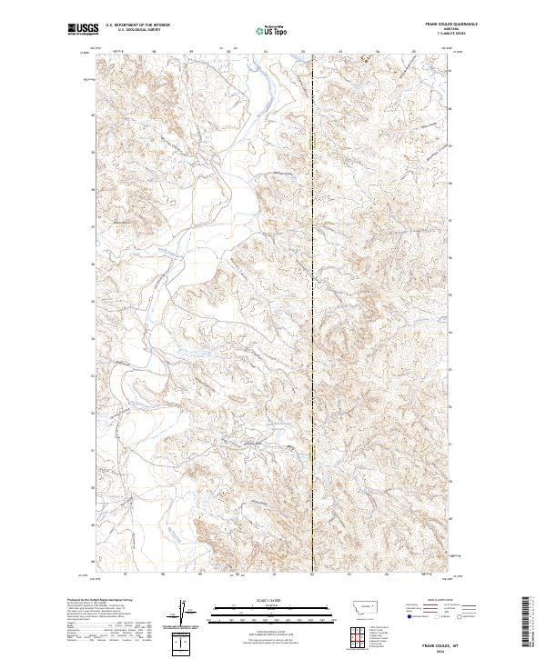
2024 Map of Frank Coulee
USGS Topo · Published 2024About this map
The Charles M Russell National Wildlife Refuge dominates the northern reaches of this landscape, where the broken terrain transitions toward the drainage of Big Dry Creek. This high plains region, surveyed in 2024, is defined by an intricate network of coulees—deep, often dry drainage channels—that carve through the Garfield and McCone County line. Distinctive landmarks such as Standing Rock and Indian Rocks provide orientation across the undulating surface, while the Cedar Bed Ground Reservoir serves as a critical water source in this arid environment. The map details a remote infrastructure of section lines and the winding Van Norman Rd, illustrating how modern land management and wildlife conservation overlay a traditional ranching landscape marked by family-named features like Bigney Coulee and Halfdahl Coulee.
Find a feature on this map
30 named features on this map. Tap any name to fly to it.
Don’t see what you’re looking for? This feature index may not catch every label — zoom into the map to look around manually.
Map Details
Editions of this 2024 Frank Coulee Map
This is the sole edition of this map. No revisions or reprints were ever made.
Other maps of this area

1954 · Jordan
USGS Topo · 1:250,000

1956 · Jordan
USGS Topo · 1:250,000

1958 · Jordan
USGS Topo · 1:250,000

1964 · Jordan
USGS Topo · 1:250,000

1967 · Hagen Gap
USGS Topo · 1:24,000
1967 · Maxwell Coulee
USGS Topo · 1:24,000

1967 · Coal Creek
USGS Topo · 1:24,000

1967 · Frank Coulee
USGS Topo · 1:24,000

1972 · Short Creek
USGS Topo · 1:24,000

1972 · Flat Creek School
USGS Topo · 1:24,000