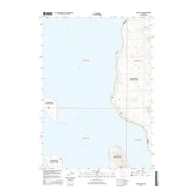
2015 Map of Frank Island
USGS Topo · Published 2015About this map
Yellowstone Lake dominates this landscape, its expansive waters surrounding Frank Island and several prominent landforms along the eastern shore. The map illustrates a remote section of Yellowstone National Park, where the water meets the timbered slopes of the Absaroka Range. Along the rugged shoreline, distinct geographic features like Elk Point, Park Point, and Signal Point serve as markers for boaters and backcountry travelers navigating the park's interior.
Find a feature on this map
16 named features on this map. Tap any name to fly to it.
Don’t see what you’re looking for? This feature index may not catch every label — zoom into the map to look around manually.
Map Details
Editions of this 2015 Frank Island Map
This is the sole edition of this map. No revisions or reprints were ever made.
Other maps of this area

1885 · Lake
USGS Topo · 1:125,000

1886 · Canyon
USGS Topo · 1:125,000

1895 · Canyon
USGS Topo · 1:125,000

1895 · Lake
USGS Topo · 1:125,000

1896 · Lake
USGS Topo · 1:125,000

1896 · Canyon
USGS Topo · 1:125,000

1901 · Canyon
USGS Topo · 1:125,000

1901 · Lake
USGS Topo · 1:125,000

1906 · Lake
USGS Topo · 1:125,000

1907 · Canyon
USGS Topo · 1:125,000