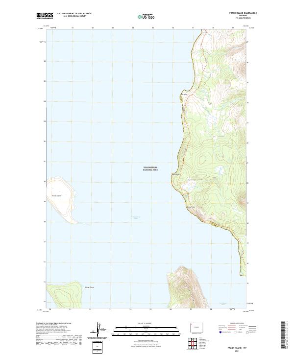
2021 Map of Frank Island
USGS Topo · Published 2021About this map
Yellowstone Lake dominates this wilderness landscape, centered on the prominent landmass of Frank Island and the jagged eastern shoreline of the lake. Within the boundaries of Yellowstone National Park, the map reveals a remote environment where human infrastructure is limited to the historic Thorofare Trl, which skirts the water's edge. This vital backcountry artery connects various geographical landmarks including Elk Point, Park Point, and Signal Point, providing the primary terrestrial access through the dense forests and steep drainage basins.
Find a feature on this map
19 named features on this map. Tap any name to fly to it.
Don’t see what you’re looking for? This feature index may not catch every label — zoom into the map to look around manually.
Map Details
Editions of this 2021 Frank Island Map
This is the sole edition of this map. No revisions or reprints were ever made.
Other maps of this area

1885 · Lake
USGS Topo · 1:125,000

1886 · Canyon
USGS Topo · 1:125,000

1895 · Canyon
USGS Topo · 1:125,000

1895 · Lake
USGS Topo · 1:125,000

1896 · Lake
USGS Topo · 1:125,000

1896 · Canyon
USGS Topo · 1:125,000

1901 · Canyon
USGS Topo · 1:125,000

1901 · Lake
USGS Topo · 1:125,000

1906 · Lake
USGS Topo · 1:125,000

1907 · Canyon
USGS Topo · 1:125,000