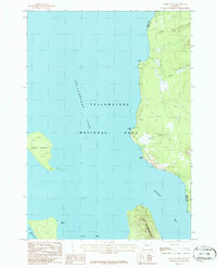
1986 Map of Frank Island
USGS Topo · Published 1986About this map
Frank Island stands as a prominent geographic feature within the southeastern waters of Yellowstone Lake in this 1980s-era topographic study. The map documents the intricate shoreline where the Southeast Arm meets the wilderness of Yellowstone National Park. To the east, the terrain rises sharply from the water's edge, marked by key navigation and landing sites such as Elk Point, Park Point, and Signal Point.
Find a feature on this map
16 named features on this map. Tap any name to fly to it.
Don’t see what you’re looking for? This feature index may not catch every label — zoom into the map to look around manually.
Map Details
Editions of this 1986 Frank Island Map
This is the sole edition of this map. No revisions or reprints were ever made.
Other maps of this area

1885 · Lake
USGS Topo · 1:125,000

1886 · Canyon
USGS Topo · 1:125,000

1895 · Canyon
USGS Topo · 1:125,000

1895 · Lake
USGS Topo · 1:125,000

1896 · Lake
USGS Topo · 1:125,000

1896 · Canyon
USGS Topo · 1:125,000

1901 · Canyon
USGS Topo · 1:125,000

1901 · Lake
USGS Topo · 1:125,000

1906 · Lake
USGS Topo · 1:125,000

1907 · Canyon
USGS Topo · 1:125,000