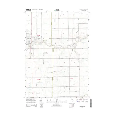
2014 Map of Frankenmuth
USGS Topo · Published 2014About this map
The city of Frankenmuth and the neighboring settlement of Tuscola are the primary focal points of this 2014 survey, which covers the border between Saginaw and Tuscola Counties. The landscape is defined by the winding course of the Cass River, which cuts through the center of the quadrangle and is fed by a complex drainage network including Cheboyganing Cr, Millington Cr, and Dead Cr. The map preserves the names of numerous smaller waterways and agricultural improvements, such as Rousch Drain and Ortner Drain, reflecting the area's deep ties to the land and water management.
Find a feature on this map
94 named features on this map. Tap any name to fly to it.
Don’t see what you’re looking for? This feature index may not catch every label — zoom into the map to look around manually.
Map Details
Editions of this 2014 Frankenmuth Map
This is the sole edition of this map. No revisions or reprints were ever made.
Other maps of this area

1919 · Saginaw
USGS Topo · 1:62,500

1919 · Burt
USGS Topo · 1:62,500

1920 · Flint
USGS Topo · 1:62,500

1921 · Burt
USGS Topo · 1:62,500

1922 · Flint
USGS Topo · 1:62,500

1941 · Saginaw
USGS Topo · 1:62,500

1943 · Burt
USGS Topo · 1:62,500

1943 · Saginaw
USGS Topo · 1:62,500

1943 · Flint
USGS Topo · 1:62,500

1954 · Flint
USGS Topo · 1:250,000
Featured Places
- Frankenmuth, City of Frankenmuth
- City of Frankenmuth, MI
- Tuscola, MI
- Tuscola Township, MI
- Birch Run Township, MI