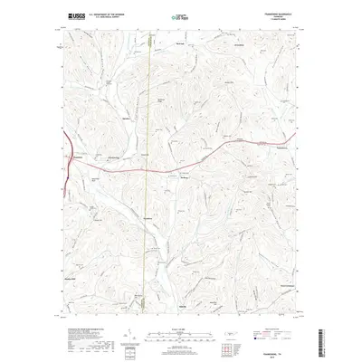
2019 Map of Frankewing
USGS Topo · Published 2019About this map
Bradshaw Creek and its many forks define the landscape of this southern Tennessee borderland, where the boundary between Giles and Lincoln counties cuts through steep hills and hollows. The settlement of Frankewing sits near the crossing of Bradshaw Creek and Old US Hwy 64, serving as a central point for a network of rural communities including McBurg, Taylortown, and Woodrow. The area is densely packed with family-named cemeteries such as Hovis-Gregory Cem, Rambo Cem, and Wright Cem, reflecting generations of local history and family ties to the land.
Find a feature on this map
133 named features on this map. Tap any name to fly to it.
Don’t see what you’re looking for? This feature index may not catch every label — zoom into the map to look around manually.
Map Details
Editions of this 2019 Frankewing Map
This is the sole edition of this map. No revisions or reprints were ever made.
Other maps of this area

1936 · Cornersville
USGS Topo · 1:24,000

1936 · Taft
USGS Topo · 1:24,000

1936 · Boonshill
USGS Topo · 1:24,000

1936 · Brick Church
USGS Topo · 1:24,000

1936 · Petersburg
USGS Topo · 1:24,000

1936 · Tarpley
USGS Topo · 1:24,000

1936 · Elkton
USGS Topo · 1:24,000

1936 · Frankewing
USGS Topo · 1:24,000

1936 · Dellrose
USGS Topo · 1:24,000

1944 · Shelbyville
USGS Topo · 1:100,000