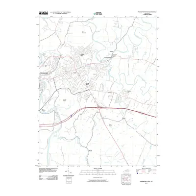
2010 Map of Frankfort East
USGS Topo · Published 2010About this map
The Kentucky River winds along the western edge of the state capital, where Fort Hill stands as a prominent landmark overlooking the city of Frankfort. This landscape is defined by the complex convergence of three major waterways: Elkhorn Creek, North Elkhorn Creek, and South Elkhorn Creek. These streams create a distinct geographic pocket at the Forks of Elkhorn, where the South Trimble Memorial Bridge spans the water. To the north, a dramatic narrow ridge known as The Backbone rises above the looping curves of the creek.
Find a feature on this map
47 named features on this map. Tap any name to fly to it.
Don’t see what you’re looking for? This feature index may not catch every label — zoom into the map to look around manually.
Map Details
Editions of this 2010 Frankfort East Map
This is the sole edition of this map. No revisions or reprints were ever made.
Other maps of this area

1906 · Lockport
USGS Topo · 1:48,000

1906 · Georgetown
USGS Topo · 1:62,500

1908 · Lockport
USGS Topo · 1:62,500

1908 · Georgetown
USGS Topo · 1:62,500

1922 · Frankfort
USGS Topo · 1:48,000

1924 · Frankfort
USGS Topo · 1:62,500

1939 · Sadieville
USGS Topo · 1:62,500

1951 · Lawrenceburg
USGS Topo · 1:24,000

1952 · Midway
USGS Topo · 1:24,000
1953 · Frankfort West
USGS Topo · 1:24,000