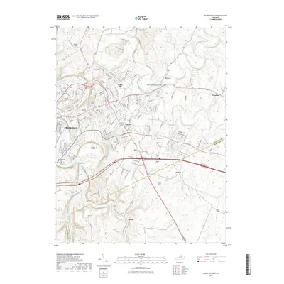
2019 Map of Frankfort East
USGS Topo · Published 2019About this map
Frankfort and its eastern suburbs spread across the Kentucky River valley, where the water carves deep bends at Saffells Bend and Big Eddy. This 2019 survey captures the capital city's modern footprint, including the campus of Kentucky State University and the extensive grounds of the Frankfort Cemetery. Moving away from the urban center, the landscape transitions into the rolling Bluegrass horse country, dotted with smaller communities such as Jett, Duckers, and Millville.
Find a feature on this map
158 named features on this map. Tap any name to fly to it.
Don’t see what you’re looking for? This feature index may not catch every label — zoom into the map to look around manually.
Map Details
Editions of this 2019 Frankfort East Map
This is the sole edition of this map. No revisions or reprints were ever made.
Other maps of this area

1906 · Lockport
USGS Topo · 1:48,000

1906 · Georgetown
USGS Topo · 1:62,500

1908 · Lockport
USGS Topo · 1:62,500

1908 · Georgetown
USGS Topo · 1:62,500

1922 · Frankfort
USGS Topo · 1:48,000

1924 · Frankfort
USGS Topo · 1:62,500

1939 · Sadieville
USGS Topo · 1:62,500

1951 · Lawrenceburg
USGS Topo · 1:24,000

1952 · Midway
USGS Topo · 1:24,000
1953 · Frankfort West
USGS Topo · 1:24,000