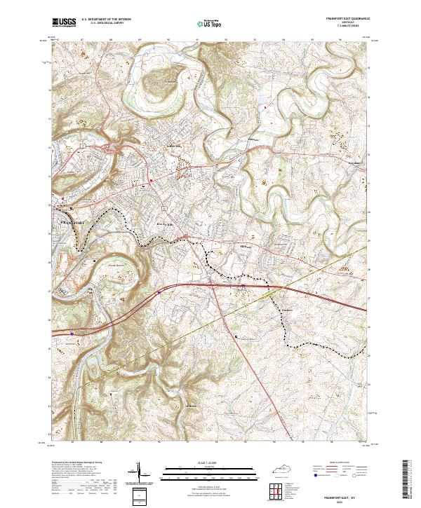
2022 Map of Frankfort East
USGS Topo · Published 2022About this map
The Kentucky River carves a deep, winding course through this portion of the Bluegrass region, defining the capital city's landscape and providing a dramatic setting for the Supreme Court of Kentucky and Kentucky State University. The terrain is characterized by sharp relief and distinctive geomorphology, most notably at the narrow ridge known as The Backbone and the river bend at Big Eddy. Beyond the central bustle of Frankfort, the map documents a network of established suburban developments like Indian Hills and Bon Air Hills, which give way to the more rural character of Trumbo Bottom and the crossroads at Jett. To the south and east, the land transitions into rolling hills where South Elkhorn Creek and Glenns Creek drain toward the river, supporting small communities and historic burial sites such as the Cook Cem and Sunset Memorial Gardens.
Find a feature on this map
173 named features on this map. Tap any name to fly to it.
Don’t see what you’re looking for? This feature index may not catch every label — zoom into the map to look around manually.
Map Details
Editions of this 2022 Frankfort East Map
This is the sole edition of this map. No revisions or reprints were ever made.
Other maps of this area

1906 · Lockport
USGS Topo · 1:48,000

1906 · Georgetown
USGS Topo · 1:62,500

1908 · Lockport
USGS Topo · 1:62,500

1908 · Georgetown
USGS Topo · 1:62,500

1922 · Frankfort
USGS Topo · 1:48,000

1924 · Frankfort
USGS Topo · 1:62,500

1939 · Sadieville
USGS Topo · 1:62,500

1951 · Lawrenceburg
USGS Topo · 1:24,000

1952 · Midway
USGS Topo · 1:24,000
1953 · Frankfort West
USGS Topo · 1:24,000