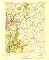
1953 Map of Frankfort East
USGS Topo · Published 1955About this map
Kentucky River loops sharply around the state capital, creating the dramatic topographical formation known as The Backbone. This mid-century survey captures the expanding residential landscape of eastern Frankfort, where neighborhoods like Normal Heights, Thorn Hill Heights, and Crestwood overlook the winding river valley. Outside the city center, the terrain is defined by the meandering South Elkhorn Creek and North Elkhorn Creek, which converge at the historic settlement of Forks of Elkhorn. The map documents a deeply rooted rural infrastructure, from the State College and State Training Home Farm to smaller agrarian hubs like Duckers and Millville. Genealogists will find significant detail in the placement of numerous community landmarks, including Woodburn Sch, Macedonia Ch, and Buck Run Ch, alongside various unnamed family cemeteries scattered across Vaughn Bottom and Hickman Hill.
Find a feature on this map
60 named features on this map. Tap any name to fly to it.
Don’t see what you’re looking for? This feature index may not catch every label — zoom into the map to look around manually.
Map Details
Editions of this 1953 Frankfort East Map
This is the sole edition of this map. No revisions or reprints were ever made.
Other maps of this area

1906 · Lockport
USGS Topo · 1:48,000

1906 · Georgetown
USGS Topo · 1:62,500

1908 · Lockport
USGS Topo · 1:62,500

1908 · Georgetown
USGS Topo · 1:62,500

1922 · Frankfort
USGS Topo · 1:48,000

1924 · Frankfort
USGS Topo · 1:62,500

1939 · Sadieville
USGS Topo · 1:62,500

1951 · Lawrenceburg
USGS Topo · 1:24,000

1952 · Midway
USGS Topo · 1:24,000
1953 · Frankfort West
USGS Topo · 1:24,000