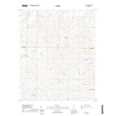
2018 Map of Frankfort
USGS Topo · Published 2018About this map
Russellville and its northern surroundings are defined by a complex network of creeks and family-named cemeteries marking the transition between the rolling hills of Franklin and Colbert counties. The landscape is structured around the Russellville Reservoir and Cedar Creek Reservoir, which anchor the southern portion of the area. One of the most significant historical markers is the Old Chickasaw Boundary Rd, tracing a legacy of early territorial divisions through the terrain. Small settlements and crossroads like Crooked Oak, Jonesboro, and Frankfort are scattered among the numerous watercourses, including Tollison Cr and Duncan Cr. The density of burial grounds such as Jonesboro Cem, Taylor Cem, and Antioch Cem suggests a long-established rural community fabric, while Burnt Church stands as a notable landmark in the eastern reaches near Lake Leola.
Find a feature on this map
86 named features on this map. Tap any name to fly to it.
Don’t see what you’re looking for? This feature index may not catch every label — zoom into the map to look around manually.
Map Details
Editions of this 2018 Frankfort Map
This is the sole edition of this map. No revisions or reprints were ever made.
Other maps of this area

1924 · Tuscumbia
USGS Topo · 1:48,000

1925 · Barton
USGS Topo · 1:62,500

1926 · Tuscumbia
USGS Topo · 1:62,500

1926 · Barton
USGS Topo · 1:48,000

1929 · Barton
USGS Topo · 1:62,500

1936 · Russellville
USGS Topo · 1:24,000

1936 · Frankfort
USGS Topo · 1:24,000

1936 · Pleasant Grove
USGS Topo · 1:24,000

1936 · Isbell
USGS Topo · 1:24,000

1936 · Pride
USGS Topo · 1:24,000