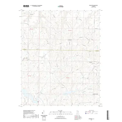
2020 Map of Frankfort
USGS Topo · Published 2020About this map
The rolling hills of northwest Alabama meet the waters of Cedar Creek Reservoir and the Russellville Reservoir in this study of the landscape south of the Colbert-Franklin county line. Near the northern reach of the city of Russellville, the terrain is defined by a dense network of creek branches, including Duncan Creek and Willis Branch, which carve through the plateau. Local history is etched into the road network, notably along Old Chickasaw Boundary Road, which follows a historical demarcation through the woods. Settlement patterns are sparse but established, centered on small communities like Crooked Oak and Jonesboro. The area is notably dotted with small family and community burial grounds, such as Antioch Cemetery and Jonesboro Cemetery, alongside landmarks like Burnt Church, providing valuable data points for genealogical research in this part of Franklin County.
Find a feature on this map
89 named features on this map. Tap any name to fly to it.
Don’t see what you’re looking for? This feature index may not catch every label — zoom into the map to look around manually.
Map Details
Editions of this 2020 Frankfort Map
This is the sole edition of this map. No revisions or reprints were ever made.
Other maps of this area

1924 · Tuscumbia
USGS Topo · 1:48,000

1925 · Barton
USGS Topo · 1:62,500

1926 · Tuscumbia
USGS Topo · 1:62,500

1926 · Barton
USGS Topo · 1:48,000

1929 · Barton
USGS Topo · 1:62,500

1936 · Russellville
USGS Topo · 1:24,000

1936 · Frankfort
USGS Topo · 1:24,000

1936 · Pleasant Grove
USGS Topo · 1:24,000

1936 · Isbell
USGS Topo · 1:24,000

1936 · Pride
USGS Topo · 1:24,000