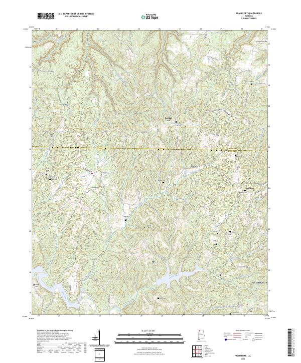
2024 Map of Frankfort
USGS Topo · Published 2024About this map
Old Chickasaw Boundary Rd runs through the northwestern portion of this region, marking a historical boundary line that predates the modern county divisions between Colbert and Franklin. The landscape is defined by the headwaters of numerous waterways, including Duncan Creek, Tollison Creek, and Miller Branch, which carve through the terrain near Underwood Mtn. Small rural communities such as Crooked Oak and Jonesboro serve as local hubs, while the northern outskirts of Russellville appear in the southeast corner. Genealogists will find a significant density of family and community burial sites, from the centrally located Old Frankfort Cem to more remote locations like Malone Cem and Sparks Cem. The presence of Lake Beola and the winding course of Mose Branch further illustrate the area's complex drainage pattern, which has long influenced the placement of farms and cemeteries across these hills.
Find a feature on this map
86 named features on this map. Tap any name to fly to it.
Don’t see what you’re looking for? This feature index may not catch every label — zoom into the map to look around manually.
Map Details
Editions of this 2024 Frankfort Map
This is the sole edition of this map. No revisions or reprints were ever made.
Other maps of this area

1924 · Tuscumbia
USGS Topo · 1:48,000

1925 · Barton
USGS Topo · 1:62,500

1926 · Tuscumbia
USGS Topo · 1:62,500

1926 · Barton
USGS Topo · 1:48,000

1929 · Barton
USGS Topo · 1:62,500

1936 · Russellville
USGS Topo · 1:24,000

1936 · Frankfort
USGS Topo · 1:24,000

1936 · Pleasant Grove
USGS Topo · 1:24,000

1936 · Isbell
USGS Topo · 1:24,000

1936 · Pride
USGS Topo · 1:24,000