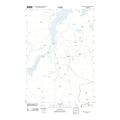
2010 Map of Franklin Falls
USGS Topo · Published 2010About this map
Franklin Falls serves as a focal point in this landscape where the Saranac River is harnessed for power and passage through the Adirondack Park. The geography is defined by significant water bodies such as Union Falls Pond and Franklin Falls Pond, reflecting the 20th-century history of hydroelectric development and recreational change in Clinton County. Small settlements like Forestdale and West Kilns sit along a network of historic routes including Plank Rd and Forestdale Rd, providing a look at local timber and industrial heritage. Genealogists can locate Union Cemetery and Goodspeed Cemetery positioned near Lincoln Brook. The terrain transitions from the heights of Esther Mountain and Lookout Mountain in the south to the northern ridges of Bear Mountain and Keegan Hill.
Find a feature on this map
55 named features on this map. Tap any name to fly to it.
Don’t see what you’re looking for? This feature index may not catch every label — zoom into the map to look around manually.
Map Details
Editions of this 2010 Franklin Falls Map
This is the sole edition of this map. No revisions or reprints were ever made.
Other maps of this area

1896 · Lake Placid
USGS Topo · 1:62,500

1898 · Lake Placid
USGS Topo · 1:62,500

1902 · Saranac
USGS Topo · 1:62,500

1904 · Saranac
USGS Topo · 1:62,500

1906 · Loon Lake
USGS Topo · 1:62,500

1908 · Loon Lake
USGS Topo · 1:62,500

1911 · Lyon Mountain
USGS Topo · 1:62,500

1913 · Lyon Mountain
USGS Topo · 1:62,500

1931 · Lyon Mountain
USGS Topo · 1:62,500

1948 · Ogdensburg
USGS Topo · 1:250,000