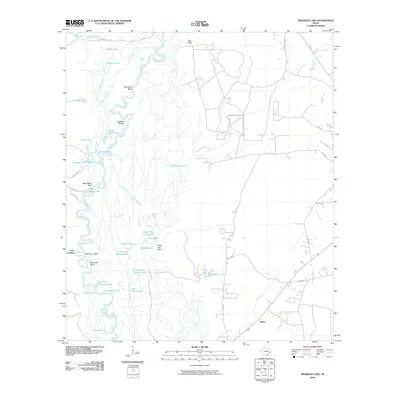
2010 Map of Franklin Lake
USGS Topo · Published 2010About this map
Neches River meanders through this portion of Southeast Texas, defining a landscape of complex waterways and seasonal wetlands. The river's winding course creates numerous oxbows and named features like Old Stove Bend, Cocklebur Bend, and Goatneck Bend, highlighting the dynamic nature of the river valley. Low-lying areas are filled with countless bodies of water, including Franklin Lake, Pool Stave Camp Lake, and the distinctly named Bear Mans Lake.
Find a feature on this map
53 named features on this map. Tap any name to fly to it.
Don’t see what you’re looking for? This feature index may not catch every label — zoom into the map to look around manually.
Map Details
Editions of this 2010 Franklin Lake Map
This is the sole edition of this map. No revisions or reprints were ever made.
Other maps of this area

1952 · Lake Charles
USGS Topo · 1:250,000

1954 · Lake Charles
USGS Topo · 1:250,000

1954 · Beaumont
USGS Topo · 1:250,000

1955 · Silsbee
USGS Topo · 1:62,500

1955 · Bessmay
USGS Topo · 1:62,500

1957 · Beaumont
USGS Topo · 1:250,000

1958 · Spurger
USGS Topo · 1:62,500

1958 · Kirbyville
USGS Topo · 1:62,500

1984 · Beaumont
USGS Topo · 1:250,000

1984 · Potato Patch Lake
USGS Topo · 1:24,000