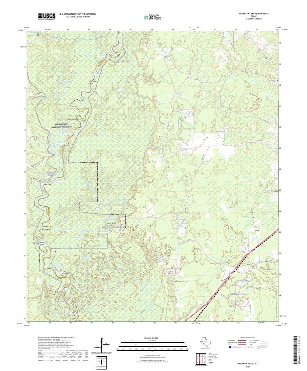
2022 Map of Franklin Lake
USGS Topo · Published 2022About this map
Big Thicket National Preserve dominates the landscape across the boundary of Hardin and Jasper Counties in this modern topographical survey. The Neches River basin defines the western portion of the map, carving a complex series of oxbows and secondary channels such as Old Stove Bend, Cocklebur Bend, and Goatneck Bend. This intricate fluvial environment is characterized by a high density of named water bodies, including Franklin Lake, Fish Lake, and Bear Mans Lake, alongside named high points like Peach Tree Point and Bear Mans Bluff. To the east, the terrain transitions into more stable ground drained by Mill Creek, where a network of county roads services local properties. Genealogy researchers can find the Antioch Cem near the junction of FM 1004 Rd W, a rare upland landmark in a region otherwise defined by the dense bottomlands of the Big Thicket National Preserve.
Find a feature on this map
64 named features on this map. Tap any name to fly to it.
Don’t see what you’re looking for? This feature index may not catch every label — zoom into the map to look around manually.
Map Details
Editions of this 2022 Franklin Lake Map
This is the sole edition of this map. No revisions or reprints were ever made.
Other maps of this area

1952 · Lake Charles
USGS Topo · 1:250,000

1954 · Lake Charles
USGS Topo · 1:250,000

1954 · Beaumont
USGS Topo · 1:250,000

1955 · Silsbee
USGS Topo · 1:62,500

1955 · Bessmay
USGS Topo · 1:62,500

1957 · Beaumont
USGS Topo · 1:250,000

1958 · Spurger
USGS Topo · 1:62,500

1958 · Kirbyville
USGS Topo · 1:62,500

1984 · Beaumont
USGS Topo · 1:250,000

1984 · Potato Patch Lake
USGS Topo · 1:24,000