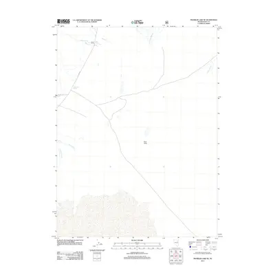
2012 Map of Franklin Lake NE
USGS Topo · Published 2012About this map
Ruby Valley serves as the central geographic anchor for this northeastern Nevada landscape, where water resources define the sparse human presence. The northern section is marked by Smith Ranch, positioned near the convergence of Myers Cr and Battle Cr. These seasonal drainages, along with Colonel Moore Cr and the Franklin River, highlight the critical role of riparian corridors in the high desert environment. Local transportation is facilitated by Co Hwy 788 and Nfd 512 Rd, which connect the ranching homesteads to the wider region. Of particular interest to those studying local hydrology or natural landmarks is the presence of Millers Hot Springs, while the southern reaches are dominated by the winding paths of Overland Cr and Griswolds Creek.
Find a feature on this map
11 named features on this map. Tap any name to fly to it.
Don’t see what you’re looking for? This feature index may not catch every label — zoom into the map to look around manually.
Map Details
Editions of this 2012 Franklin Lake NE Map
This is the sole edition of this map. No revisions or reprints were ever made.
Other maps of this area

1935 · Halleck
USGS Topo · 1:125,000

1955 · Elko
USGS Topo · 1:250,000

1958 · Elko
USGS Topo · 1:250,000

1962 · Elko
USGS Topo · 1:250,000

1962 · Lamoille
USGS Topo · 1:62,500

1965 · Elko
USGS Topo · 1:250,000

1968 · Franklin Lake SE
USGS Topo · 1:24,000

1968 · Franklin Lake SW
USGS Topo · 1:24,000

1968 · Franklin Lake NE
USGS Topo · 1:24,000
1969 · Franklin Lake NW
USGS Topo · 1:24,000