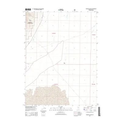
2014 Map of Franklin Lake NE
USGS Topo · Published 2014About this map
The Ruby Mountains dominate the western edge of this landscape, where the steep terrain falls within the Humboldt National Forest. Small waterways like Myers Cr and Battle Cr drain from these heights toward the broad expanse of the Ruby Valley. This area represents a classic Great Basin environment, where seasonal and perennial waters descend from high elevations to vanish into the basin floor or feed more substantial features like the Franklin River in the east.
Find a feature on this map
15 named features on this map. Tap any name to fly to it.
Don’t see what you’re looking for? This feature index may not catch every label — zoom into the map to look around manually.
Map Details
Editions of this 2014 Franklin Lake NE Map
This is the sole edition of this map. No revisions or reprints were ever made.
Other maps of this area

1935 · Halleck
USGS Topo · 1:125,000

1955 · Elko
USGS Topo · 1:250,000

1958 · Elko
USGS Topo · 1:250,000

1962 · Elko
USGS Topo · 1:250,000

1962 · Lamoille
USGS Topo · 1:62,500

1965 · Elko
USGS Topo · 1:250,000

1968 · Franklin Lake SE
USGS Topo · 1:24,000

1968 · Franklin Lake SW
USGS Topo · 1:24,000

1968 · Franklin Lake NE
USGS Topo · 1:24,000
1969 · Franklin Lake NW
USGS Topo · 1:24,000