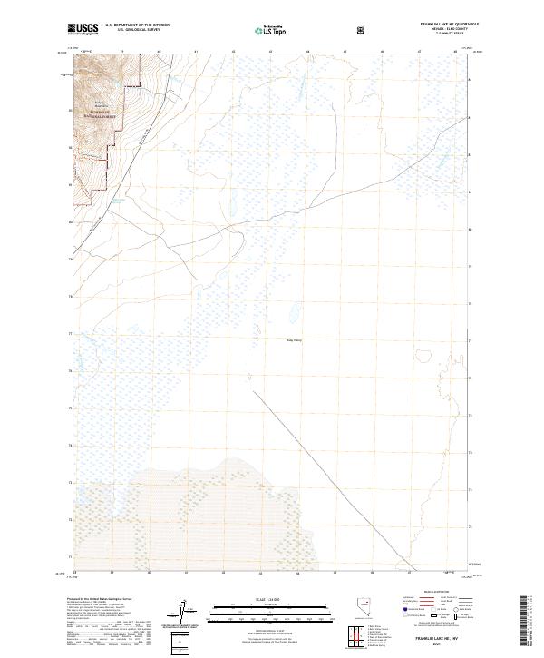
2021 Map of Franklin Lake NE
USGS Topo · Published 2021About this map
The eastern slopes of the Ruby Mountains descend into a complex wetland basin in this high-altitude Nevada landscape. Managed largely by the Humboldt National Forest, the terrain is defined by seasonal drainages such as Battle Cr, Muers Cr, and Colonel Moore Cr that feed the marshy expanse of Ruby Valley. The hydrological profile of the area is further shaped by Millers Hot Springs, while the Franklin River meanders through the eastern flats.
Find a feature on this map
17 named features on this map. Tap any name to fly to it.
Don’t see what you’re looking for? This feature index may not catch every label — zoom into the map to look around manually.
Map Details
Editions of this 2021 Franklin Lake NE Map
This is the sole edition of this map. No revisions or reprints were ever made.
Other maps of this area

1935 · Halleck
USGS Topo · 1:125,000

1955 · Elko
USGS Topo · 1:250,000

1958 · Elko
USGS Topo · 1:250,000

1962 · Elko
USGS Topo · 1:250,000

1962 · Lamoille
USGS Topo · 1:62,500

1965 · Elko
USGS Topo · 1:250,000

1968 · Franklin Lake SE
USGS Topo · 1:24,000

1968 · Franklin Lake SW
USGS Topo · 1:24,000

1968 · Franklin Lake NE
USGS Topo · 1:24,000
1969 · Franklin Lake NW
USGS Topo · 1:24,000